

By DONALD WITTKOWSKI
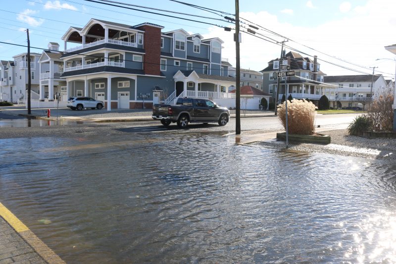
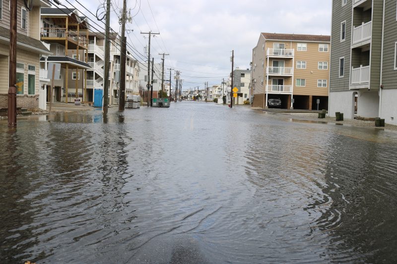
Flooded sections of Landis Avenue in Sea Isle City resembled a river on Monday afternoon, but Jeff Pellegrini was determined to check out his friend’s house to make sure it wasn’t damaged in the overnight storm that lashed the Jersey Shore.
Although other motorists turned onto side streets to avoid the flooding, Pellegrini slowly navigated his Nissan truck through the water to head up to his friend’s house at 34th Street and Landis.
Pellegrini, a Hammonton resident who is a real estate appraiser at the shore, didn’t seem fazed. He said he is an experienced driver during coastal flooding.
“When I go to Margate and Ventnor, they’re really bad. They get about two feet of water. Here, it gets to about a foot,” he said of Sea Isle’s storm flooding.

Street flooding in low-lying areas such as Landis Avenue was only one part of the storm that lashed the shore from Sunday night into Monday morning.
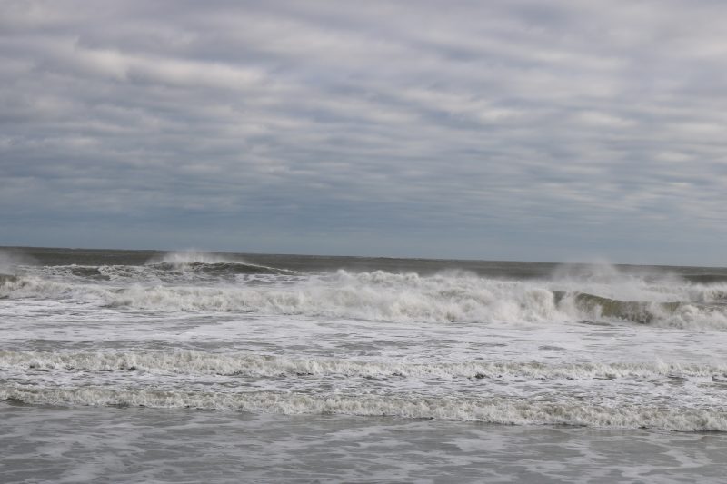
Other impacts included drenching rain, heavy wind gusts and choppy surf that inundated the downtown beaches to cause erosion.
Mike Jargowsky, Sea Isle’s emergency management coordinator, estimated that the storm surge was about 3½ feet – significantly higher than the 2 feet that had been predicted. The storm surge added to the flooding that was also caused by high tide and soaking rains.
Jargowsky characterized the flooding as being in the “high minor to low moderate” levels, especially during the high tide cycle from about midnight Sunday to 1:30 a.m. Monday.
Precipitation totals reported by the National Weather Service showed that the storm dumped at least 2.88 inches of rain on Sea Isle. Some areas of the state were swamped with 4 to 5 inches of rain.

Gale-force winds also contributed to the severity of the storm. Flags whipped in the winds overlooking Sea Isle’s Excursion Park, just steps from the beach.
Jargowsky said one wind gust that was recorded after midnight Sunday hit 53 mph. Hurricane-strength winds start at 74 mph. Strong winds also had the effect of pushing water up into the streets to add to the flooding.
Despite the widespread impacts of the storm, Jargowsky said he didn’t hear of any reports of property damage.
The timing of the storm – occurring overnight Sunday into Monday morning – made it a virtual replay of the Dec. 10-11 coastal storm that hit Sea Isle and other shore communities with heavy rain and winds.
Jargowsky, though, pointed out that the Dec. 10-11 storm wasn’t as strong, in large part because drenching rains didn’t coincide with high tide to create the type of flooding levels that occurred overnight Sunday into Monday.
“The timing of the rain helped us with the last storm with the flooding,” he said.
As with other significant coastal storms, Sea Isle put out alerts and storm warnings ahead of time over the weekend, including reminders for residents to be careful around floodwaters and not to park their vehicles in low-lying areas.


