By DONALD WITTKOWSKI
Tropical Storm Isaias is expected to unleash heavy rain, flash flooding and winds gusting to near hurricane strength at the Jersey Shore starting Tuesday morning and continuing through what will likely be a tumultuous afternoon and evening.
Mike Jargowsky, emergency management coordinator for Sea Isle City, said sustained winds could approach 65 mph in the storm’s core, raising the potential for downed trees and damage to homes and businesses on the island.
“From my vantage point, I’m more concerned about the wind,” Jargowsky said. “We’re really going to get gusty, tropical force winds and at times we may get hurricane force winds.”
He added, “Trees and shingles are really going to be put to the test in this storm.”
Sea Isle is urging property owners to secure their patio furniture, awnings, trash cans, umbrellas and any other objects that could be blown away by powerful winds.
Combined with heavy winds throughout the day, the storm is expected to lash the shore with flash flooding and drenching rainfall of up to 2 inches before it begins to move away Tuesday night.
Sea Isle issued a series of weather alerts throughout Monday to warn residents and visitors. Police are urging everyone to seek shelter at home to stay safe while the storm passes through the area.

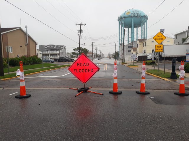
Flash flooding is another serious threat associated with the tropical storm. Jargowsky warned of flooding in Sea Isle’s low-lying areas, especially coinciding with the arrival of high tide at around 10 p.m. Tuesday on the bay side.
He urged motorists not to try to drive through flooded areas because the wakes of water created by their vehicles can damage homes and businesses. Motorists risk getting tickets from police if they cause damaging wakes.
Rough surf and dangerous rip currents can be expected on Sea Isle’s beaches through at least Wednesday. Beachgoers should not swim in areas not protected by lifeguards and should probably stay out of the water altogether Tuesday, Jargowsky said.
Sea Isle’s newly replenished beaches between 28th and 52nd streets should provide the city with extra protection during the storm, he noted. The project has widened the beaches with extra sand to create an even bigger buffer between the ocean and homes and businesses in the midsection of town.
“That extra sand will help,” Jargowsky said. “It’s definitely going to be quickly put to use.”
Beaches in Townsends Inlet in the south end of town between 74th and 93rd streets are also being restored with new sand, but that part of the replenishment project is still underway.

Tropical Storm Isaias is arriving just three weeks after Tropical Storm Fay dumped heavy rain and caused widespread flooding at the Jersey Shore on July 10.
“We’ve had two tropical storms in one summer. It’s a first. Hopefully, it’s a last,” Jargowsky said.
Sea Isle announced the following cancellations and changes for Tuesday with city services and special events:
- Tuesday’s Beachcomber Guided Tour is canceled.
- Tuesday’s Farmers Market at Excursion Park is canceled.
- The National Night Out Family Movie planned for Tuesday night at Excursion Park will be shown on Wednesday evening at dusk.
- Jitney Service is canceled for Tuesday.
- Curbside trash and recycling collections will not take place on Tuesday. Streets that normally have collections on Tuesday will have their trash and recycling collected on Friday.
- The Trash Depot/Recycling Drop-Off Area at 401 JFK Boulevard will be closed on Tuesday.
Anyone needing police assistance during the storm should call 609-263-4311. Dial 911 in the event of an emergency.


