

By Donald Wittkowski
Cape May County plans to restripe the narrow corridor linking Sea Isle City with Upper Township to create wider shoulders that will keep bicyclists and pedestrians out of the way of motor vehicle traffic.
The project was originally expected to get underway this summer, but instead will likely begin in late fall or early spring once Sea Isle and Upper Township officials give their approval, said Robert Church, the county’s newly appointed engineer.
“We will be forwarding these plans to both the City of Sea Isle and Upper Township for their final review and concurrence within the next few days. It is our intention that once we receive concurrence from the municipalities, we will then go out to bid in hopes of a late fall, or if need be, early spring construction depending on the weather,” Church said in an email.
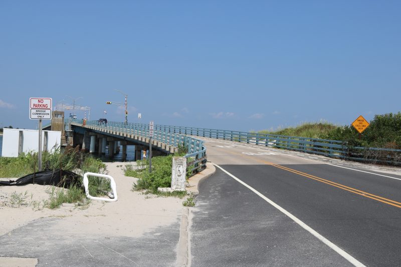
The county controls the roadway, which is variously known as Ocean Drive and Route 619. The part that runs through Sea Isle is called Landis Avenue. In the Strathmere section of Upper Township, the road is known as Commonwealth Avenue.
Its beachside location makes it a popular route for cars, bicyclists and pedestrians during the summer vacation season. However, all that activity squeezed into the narrow lanes creates hazards. A lack of sidewalks makes it even trickier for bikers and walkers.

Michael Dannemiller, principal engineer for NV5, a consulting firm that is studying the project for the county, said there were 16 motor vehicle accidents on this stretch of road between 2012 and 2016. In 2016, a bicyclist was killed by a car in Upper Township. Two pedestrians were injured when they were hit by cars, Dannemiller said.
Hoping to keep bikers and pedestrians out of harm’s way, the county plans to restripe the roadway to create buffers between them and the motor vehicle traffic.
Wider shoulders would be created by eliminating parking along the road in different stretches.
Parking would be taken away on the east side of the road between 29th and 22nd streets in Sea Isle. North of 22nd Street, parking would be eliminated on the west side of the road to Prescott Avenue, Church said.
The project also includes more visible crosswalk markings and signage – all part of what Church called “traffic-calming enhancements.”
Previously, county officials estimated the cost of the restriping plan at between $200,000 and $250,000.
The Landis Avenue-Commonwealth Avenue artery is particularly popular in the summer because it provides access to the Strathmere beaches, which do not require beach tags for the public to use.
As planning for the project moved along, the county held a public forum in April to solicit feedback from local officials and residents on different options for making the busy roadway safer.
Some of the Upper Township officials who attended the public forum wanted the county to consider reducing the speed limit to 15 mph for traffic coming off the Corsons Inlet Bridge in Strathmere, the northern tip of the corridor between Upper Township and Sea Isle.
For Sea Isle, Landis Avenue is a key artery for the beach town. Periodic shutdowns with the aged Townsends Inlet Bridge and ongoing construction with Sea Isle Boulevard sometimes leave Landis Avenue as the only way on and off the barrier island.
Sea Isle City Council President Jack Gibson said he will study the proposal for making the Landis Avenue corridor safer before he supports any particular plan.
“I appreciate the county’s attention to the traffic concerns on Landis Avenue in the north end of Sea Isle City and Commonwealth Avenue’s extension into Strathmere,” Gibson said. “I look forward to reviewing the county’s plan for our area.”


