

By DONALD WITTKOWSKI
Julie May recalled the fury of Hurricane Bob when it blew though Cotuit Bay in Cape Cod, Mass., while she was there on Aug. 19, 1991.
“It was unreal,” she said, shaking her head in amazement.
On Saturday, she was amazed again by the power of another storm – the remnants of Hurricane Ian.
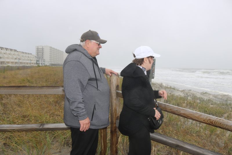
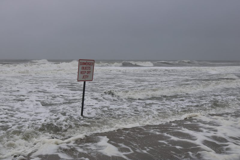
May and her husband, Richard, marveled over the imposing waves that seemed to swallow up large stretches of Sea Isle City’s beaches while pounding the shore.
“The power of nature is amazing,” Julie said.
The Mays, who live in West Chester, Pa., have a shore vacation home in Seaville. While taking a walk on Sea Isle’s near-empty oceanfront Promenade, they heard the roar of the waves crashing on shore.
“You speculate on how bad it’s going to be. But you have to be there to see it for yourself,” Richard said of the magnitude of the storm.

The remnants of Hurricane Ian also fascinated Sea Isle residents Maureen and Greg Heffron. As the winds howled, they looked out on the surging waves from a pathway to the beach at John F. Kennedy Boulevard.
“It’s crazy. It’s wild,” Maureen exclaimed. “I’ve never seen the ocean like this before.”
“It looks very powerful,” her husband, Greg, added.
Suddenly, a strong gust of wind blew Maureen’s baseball cap off her head, but she was able to catch it.
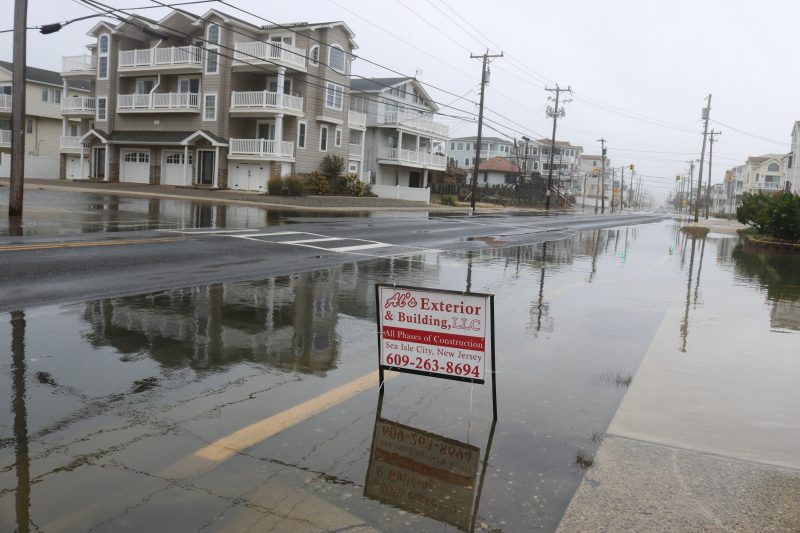
The remnants of Hurricane Ian are expected to linger through the entire weekend and early in the week, bringing more rain, high winds and minor to moderate flooding at the shore.
“It’s a bad storm, but there’s nothing severe about it. It’s life at the shore in the fall,” said Mike Jargowsky, Sea Isle’s coordinator of emergency management.
Jargowsky said Sea Isle’s residents should be all right if they follow the proper precautions, including moving their cars to higher areas of town instead of leaving them in flood-prone neighborhoods.
The National Weather Service issued a Coastal Flood Advisory in effect for Sea Isle from Saturday through 6 a.m. Monday, Oct. 3.
Jargowsky said “mid-minor flooding” is largely expected, although it could increase to moderate flooding if the conditions are right.
“My concern is rain occurring at high tide,” he said of the possibility of more flooding.
The forecast calls for at least three days of strong northeast winds and progressively increasing tide levels.
Relatively minor street flooding occurred in parts of Sea Isle on Saturday around high tide at 1 p.m. High tide arrives Sunday at approximately 2 p.m. Tides may be higher than usual on Monday also, according to a weather alert issued by the city.
Jargowsky also warned of the possibility of beach erosion in Sea Isle. On Saturday, it appeared the beaches were getting hammered by the big waves.
“They’re going to take a beating in the winter storms and fall storms,” Jargowsky said.
Sea Isle’s shoreline will be replenished with new sand in 2023 as part of an estimated $30 million project by the U.S. Army Corps of Engineers that will also include restoring the beaches in Strathmere and the southern part of Ocean City.
Meanwhile, after slamming into Florida as a deadly Category 4 hurricane, Ian headed up the East Coast through Georgia, South Carolina, North Carolina and Virginia before lashing the Jersey Shore.
Julie and Richard May braved the high winds and periodic rain to watch the storm whipping Sea Isle. Julie, 73, and Richard, 75, said they are both old enough to remember some of the worst hurricanes to ever slam the East Coast.
“There was Gloria, Hazel and Bob – a ton of them,” Julie said. “We are of the age where we’ve lived through enough of them.”
Now, they can add Ian to the list of storms they have experienced.


