

A frontal boundary near our area will keep us on the cloudy and occasionally wet side to start the week. Temperatures will still be on the cool side but not as chilly as Sunday.
Occasional drizzle and fog through the Monday morning hours as a frontal boundary lifts north and conditions improve during the day. It will remain on the cloudy side but a southerly wind will push temperatures into the 50s.
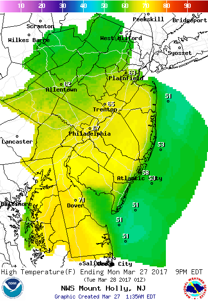 Forecast highs Monday show milder temperatures inland with high remaining in the 50s along the coast.
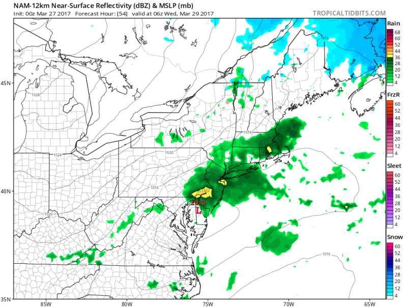
A weak area of low pressure will move through on Tuesday bringing another round of showers. Southerly winds will keep the coast on the cooler side.
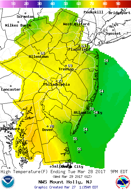 Forecast Highs on Tuesday.
Drier and sunny conditions return by Wednesday as high pressure builds in to our north. However, breezy north winds will keep us on the cool side as high temperatures will remain in the low 50s.
Our next chance of rain will arrive on Friday and Saturday as a stronger storm system will move through. Temperatures will remain in the upper 40s to low 50s.
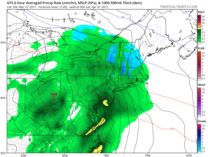 Computer models shows much more rain with the next storm on Friday-Saturday (Courtesy: tropicaltidbits.com)
Sunshine should return on Sunday will highs in the mid 50s.


