Trusted Local News

Special Weather Statement: Ian’s Remnants to Hit Shore

(Image courtesy of National Weather Service)

  • News

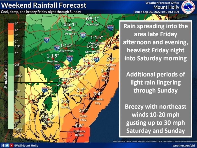
As the remnants of Hurricane Ian approach the area, Sea Isle City can expect several days of strong, gusty, northeast winds, as well as mostly minor (but possibly moderate) tidal flooding, and heavy rain at times.

While tidal flooding may not be severe, heavy rains coinciding with a high tide may cause higher than expected levels of inundation. Please be aware that afternoon tides are expected to be higher than the evening tides this weekend. High tide on Saturday afternoon is expected around 1 p.m., and on Sunday afternoon at approximately 2 p.m. Tides may be higher than usual on Monday also. To access more information about the tides, visit the Stevens Institute Tide Chart, which can be found on the “Flood Info” link on Sea Isle City’s municipal website, 
www.seaislecitynj.us, or directly at the following link: https://hudson.dl.stevens-tech.edu/sfas/d/index.shtml?station=U233 If you live in a low-lying area in Sea Isle, it may be wise to park your vehicle at the Sea Isle City Library or other areas that are not susceptible to flooding. Please do not drive through flood waters, because the wake you create can cause damage to nearby properties – and your own vehicle. Due to the approaching storm, Sea Isle City’s Welcome Center will be closed on Saturday, Oct. 1. If you need to speak with the Sea Isle Police Department at any time, call 609-263-4311, ext. 0. In the event of an emergency, call 911.
Thursday, September 19, 2024
STEWARTVILLE

MOST POPULAR

Local News to Your inbox
Enter your email address below

Events

September

S M T W T F S
25 26 27 28 29 30 31
1 2 3 4 5 6 7
8 9 10 11 12 13 14
15 16 17 18 19 20 21
22 23 24 25 26 27 28
29 30 1 2 3 4 5

To Submit an Event Sign in first

Today's Events

No calendar events have been scheduled for today.