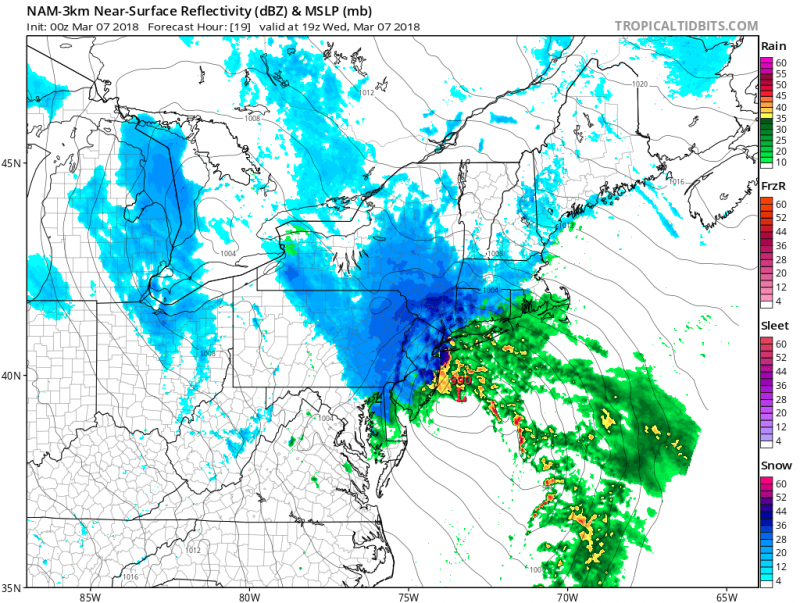
Our 2nd Nor'easter in less than a week will make for a miserable Wednesday. However, this one is moving faster and will be much weaker than the last one. Tidal flooding is not expected to be a concern as we are now coming off astronomical high tides and will only affect Wednesday morning's high tide. As a result, only spotty minor flooding is expected.
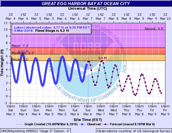
Tide forecasts expected to reach around flood stage on Wednesday morning.
As the storm develops offshore and pulls away, colder air may once again change the rain to snow before ending. Little or no accumulation is expected as surface temperatures will remain above freezing.
Winds will not be as strong as the last storm. Northeasterly winds at 20-25 mph will be gusting to around 40mph. Winds will then shift to the northwest as the storm pulls away in the afternoon.
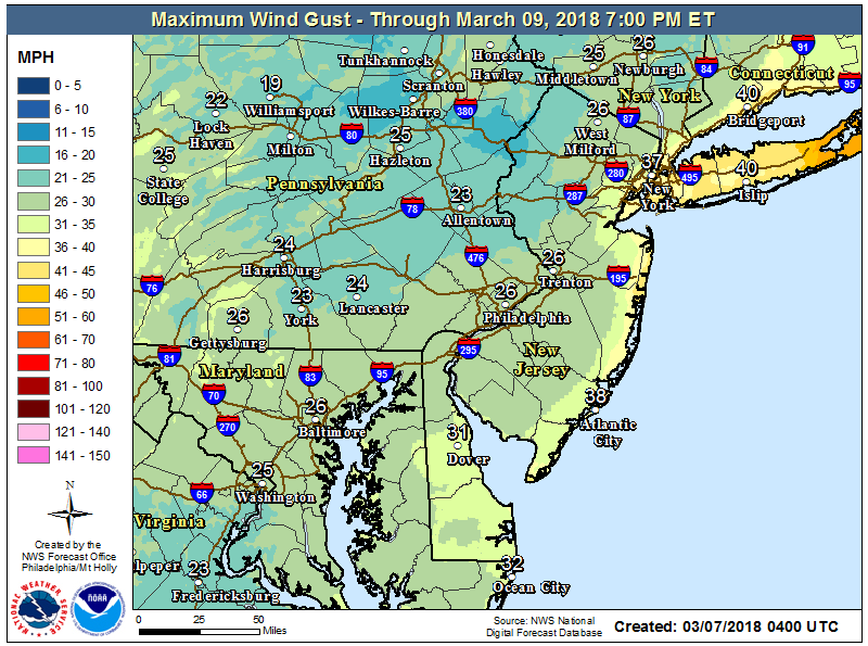
Wind Gust expected for Wednesday.
Longer duration of snow is expected well inland and as you go into the higher elevations of NJ and PA, much more snow is expected. over 6" of snow will accumulate N&W of Philadelphia with only a slushy accumulation along the NJ Turnpike and I-295 in Southern NJ.
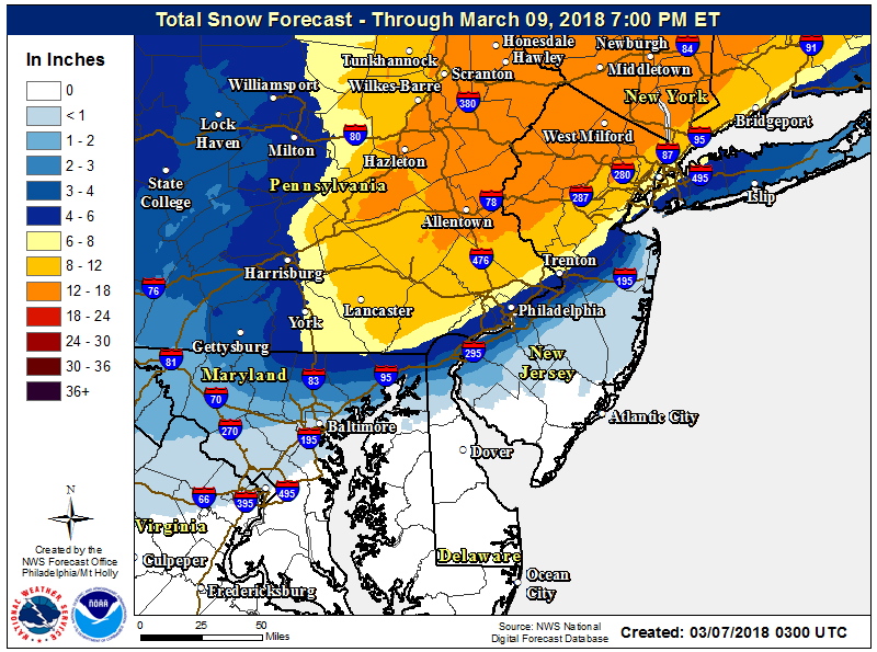
Expected Snow Totals for Wednesday.
All precipitation should end by late afternoon/early evening on Wednesday. Winds will still be busy at night with temperatures in the 30s making it feel like the teens.
 Our 2nd Nor'easter in less than a week will make for a miserable Wednesday. However, this one is moving faster and will be much weaker than the last one. Tidal flooding is not expected to be a concern as we are now coming off astronomical high tides and will only affect Wednesday morning's high tide. As a result, only spotty minor flooding is expected.
 Tide forecasts expected to reach around flood stage on Wednesday morning.
As the storm develops offshore and pulls away, colder air may once again change the rain to snow before ending. Little or no accumulation is expected as surface temperatures will remain above freezing.
Winds will not be as strong as the last storm. Northeasterly winds at 20-25 mph will be gusting to around 40mph. Winds will then shift to the northwest as the storm pulls away in the afternoon.
 Wind Gust expected for Wednesday.
Longer duration of snow is expected well inland and as you go into the higher elevations of NJ and PA, much more snow is expected. over 6" of snow will accumulate N&W of Philadelphia with only a slushy accumulation along the NJ Turnpike and I-295 in Southern NJ.
 Expected Snow Totals for Wednesday.
All precipitation should end by late afternoon/early evening on Wednesday. Winds will still be busy at night with temperatures in the 30s making it feel like the teens.