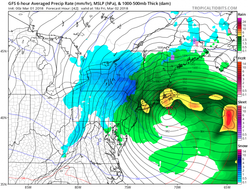
March will be coming in like a lion as a large coastal storm will develop offshore creating the potential for major coastal flooding. Although rain is not expected to be heavy, strong winds and tidal flooding will be the main concern with this storm as it rapidly develops and then stalls offshore.
Rain will begin during the day on Thursday, but winds will remain on the lighter side as the low pressure system begins to take shape off the coast. As the storm begins to intensify, winds will crank up on Friday out of the northwest 20-30mph with gusts over 50mph Friday night. Make sure you secure any lose trash cans or outdoor furniture. Trees, limbs and power lines could come down as well from the strong winds.
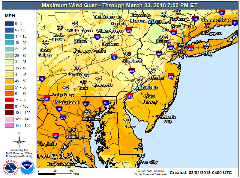
Peak wind gust expected on Friday Evening.
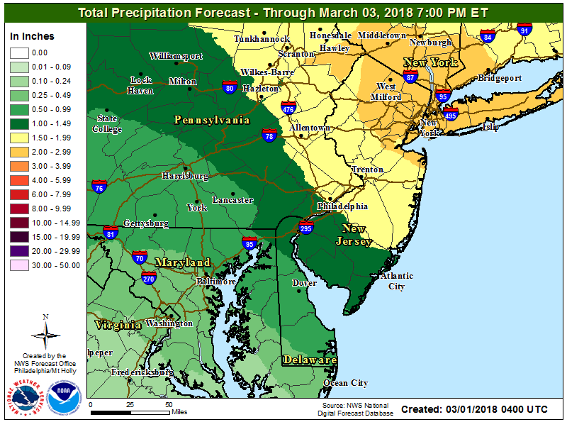
Flooding from rainfall is not expected to be an issue as amounts should remain just over 1" for the entire storm. Rain will end later on Friday but the main impacts of the storm will just be beginning.
The main concern could be the tidal flooding. Tidal forecasts have been showing the potential for flooding during several successive high tides as large swells continue to push toward the coast. In addition, we will be experiencing high astronomical tides due to the full moon. Seas will increase from 3 to 6 feet on Friday to 6 to 10 feet on Saturday. Minor flooding is expected on Friday morning as high tides will occur after 8am. Moderate to possibly major flooding could occur Saturday morning as storm surge could exceed 2 feet causing widespread flooding of roadways and properties.
Anyone parked in low lying areas are advised to move your cars to higher ground by Saturday.
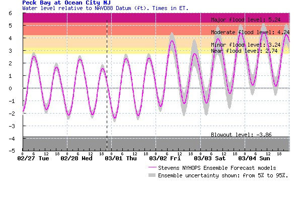
Forecast tides show potential for major flooding on Saturday.
As the storms intensifies off the coast, colder air will return as we move into the weekend. Temperatures will hold in the 40s but with the wind, it will feel much colder.
 March will be coming in like a lion as a large coastal storm will develop offshore creating the potential for major coastal flooding. Although rain is not expected to be heavy, strong winds and tidal flooding will be the main concern with this storm as it rapidly develops and then stalls offshore.
Rain will begin during the day on Thursday, but winds will remain on the lighter side as the low pressure system begins to take shape off the coast. As the storm begins to intensify, winds will crank up on Friday out of the northwest 20-30mph with gusts over 50mph Friday night. Make sure you secure any lose trash cans or outdoor furniture. Trees, limbs and power lines could come down as well from the strong winds.
 Peak wind gust expected on Friday Evening.
Flooding from rainfall is not expected to be an issue as amounts should remain just over 1" for the entire storm. Rain will end later on Friday but the main impacts of the storm will just be beginning.
 The main concern could be the tidal flooding. Tidal forecasts have been showing the potential for flooding during several successive high tides as large swells continue to push toward the coast. In addition, we will be experiencing high astronomical tides due to the full moon. Seas will increase from 3 to 6 feet on Friday to 6 to 10 feet on Saturday. Minor flooding is expected on Friday morning as high tides will occur after 8am. Moderate to possibly major flooding could occur Saturday morning as storm surge could exceed 2 feet causing widespread flooding of roadways and properties.
Anyone parked in low lying areas are advised to move your cars to higher ground by Saturday.
 Forecast tides show potential for major flooding on Saturday.
As the storms intensifies off the coast, colder air will return as we move into the weekend. Temperatures will hold in the 40s but with the wind, it will feel much colder.