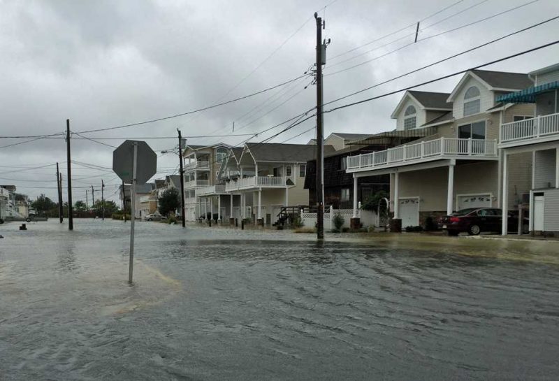
It was almost a year ago that we were dealing with a major coastal storm. The infamous Winter Storm "Jonas", as it was called, dumped heavy snow then heavy rain along the coast with strong gusty winds and significant flooding. Now another coastal storm is set to bring another dose of heavy rain, gusty winds and flooding for late Sunday into Monday. Only this time, you don't have to worry about the snow.
Rain will arrive late Sunday as a low pressure system to our south will begin moving offshore. The difference between the High Pressure to our north and Low Pressure to our south will cause a tight gradient for a period of time over our area allowing strong onshore winds to increase rapidly late Sunday night into Monday.
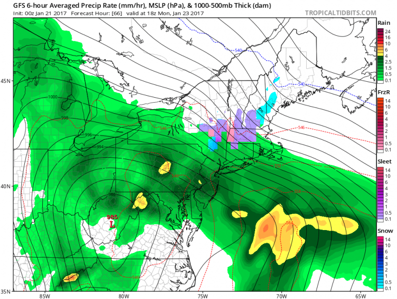
Northeast winds 20-30 mph gusting to near 50 mph especially Monday morning.
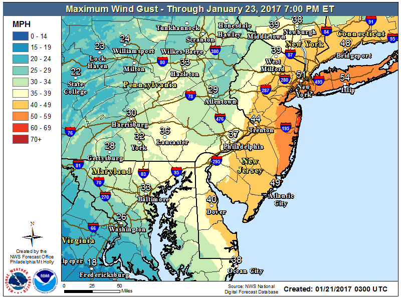
This will cause seas to build 7-12 feet with breakers along the coast around 5-8 feet. Water will begin to push into the bays and cause flooding during times of high tide. Fortunately, were are in a period of low astronomical tides so only minor flooding is expected at this time.
Sea Isle City High Tides
Monday- 4:22AM & 4:44PM
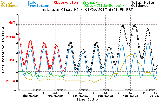
Flooding will occur as back bays fill up around 2 hours after high tide which will cause street flooding during Monday morning commute and also Monday evening.
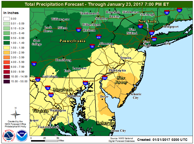
Heavy rainfall will also add to the flooding concerns as 1"-3" of rain is expected.
The wind and seas will decrease later in the day on Monday and especially Tuesday as the coastal storm lifts north and away from the coast.
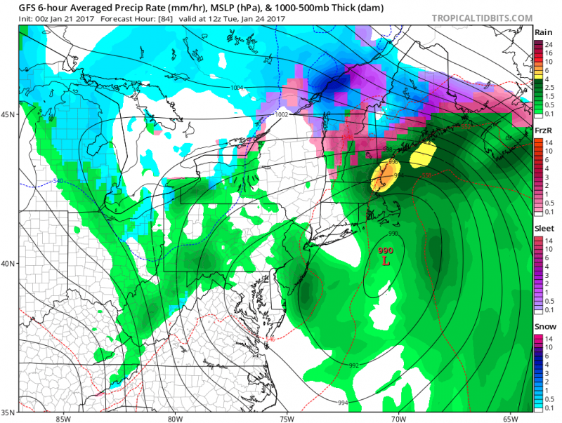
Rain will end Tuesday morning as the storm pulls away. Temperatures will continue to stay on the mild side with highs topping out around 50 degrees as we move into next week.
 It was almost a year ago that we were dealing with a major coastal storm. The infamous Winter Storm "Jonas", as it was called, dumped heavy snow then heavy rain along the coast with strong gusty winds and significant flooding. Now another coastal storm is set to bring another dose of heavy rain, gusty winds and flooding for late Sunday into Monday. Only this time, you don't have to worry about the snow.
Rain will arrive late Sunday as a low pressure system to our south will begin moving offshore. The difference between the High Pressure to our north and Low Pressure to our south will cause a tight gradient for a period of time over our area allowing strong onshore winds to increase rapidly late Sunday night into Monday.
 Northeast winds 20-30 mph gusting to near 50 mph especially Monday morning.
 This will cause seas to build 7-12 feet with breakers along the coast around 5-8 feet. Water will begin to push into the bays and cause flooding during times of high tide. Fortunately, were are in a period of low astronomical tides so only minor flooding is expected at this time.
Sea Isle City High Tides
Monday- 4:22AM & 4:44PM
 Flooding will occur as back bays fill up around 2 hours after high tide which will cause street flooding during Monday morning commute and also Monday evening.
Heavy rainfall will also add to the flooding concerns as 1"-3" of rain is expected.
 The wind and seas will decrease later in the day on Monday and especially Tuesday as the coastal storm lifts north and away from the coast.
 Rain will end Tuesday morning as the storm pulls away. Temperatures will continue to stay on the mild side with highs topping out around 50 degrees as we move into next week.