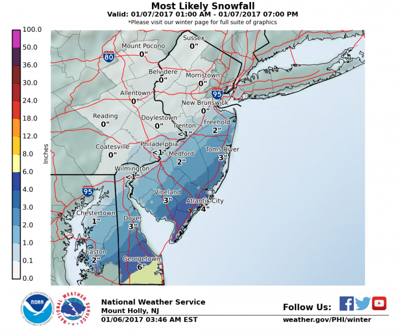
 A Winter Storm Warning is in effect for Sea Isle City for Saturday for the potential for several inches of snow.
Now that the first system has moved away, the next storm is right on its heels. As I mentioned yesterday this 2nd storm is altogether different. Instead of a developing weak low pressure system with little moisture, like the first one, this one has plenty of moisture coming out of the Gulf of Mexico. This 2nd storm will cause major problems through the Southern States and up the Mid-Atlantic Coast. Highest snow total will be across Southeastern Virginia where 8”-12” of snow is expected. For us, the biggest question has always been how far north will the moisture get to our area.
Snow should arrive around sunrise and could come down heavy at time during the morning and early afternoon hours. With temperatures mainly in the 20s, snow will easily accumulate on roadways causing hazardous travel. Snow should taper off late in the afternoon.
Models continue to have its differences even within 24 hours from the start of the snow. The slightest shift in track will determine whether we see very little snow or significant accumulations.
Let’s look at our options. There are 3 scenarios which the computer models are indicating could be possible.
The American model has tracked this storm furthest from the coast, which would result in very little snow.
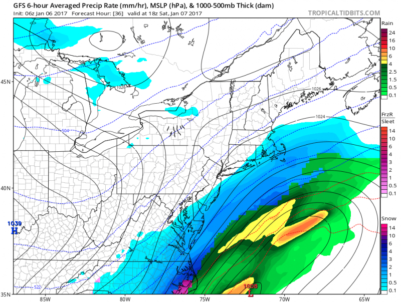 GFS snow projections show accumulations around 1"
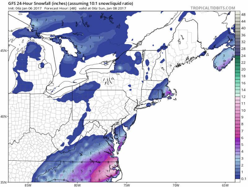
The most aggressive model, another American model, shows a much further north progression with this storm giving us the most snow.
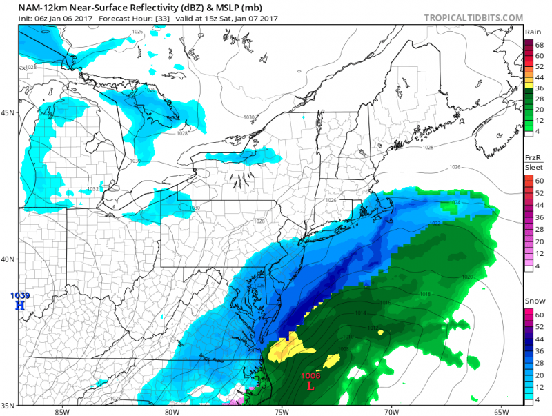
NAM model snow projections show accumulations 6"-10"
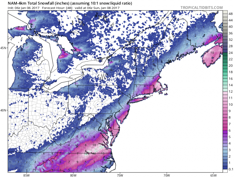 However, in forecasting, its important not to look at the extreme but a blend of the models. The Canadian and European models actually do just that. Both models track the storm in between both outlying models.
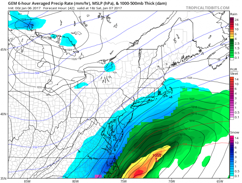
Canadian/European models projections show snow amounts ranging in the 3"-6" range.
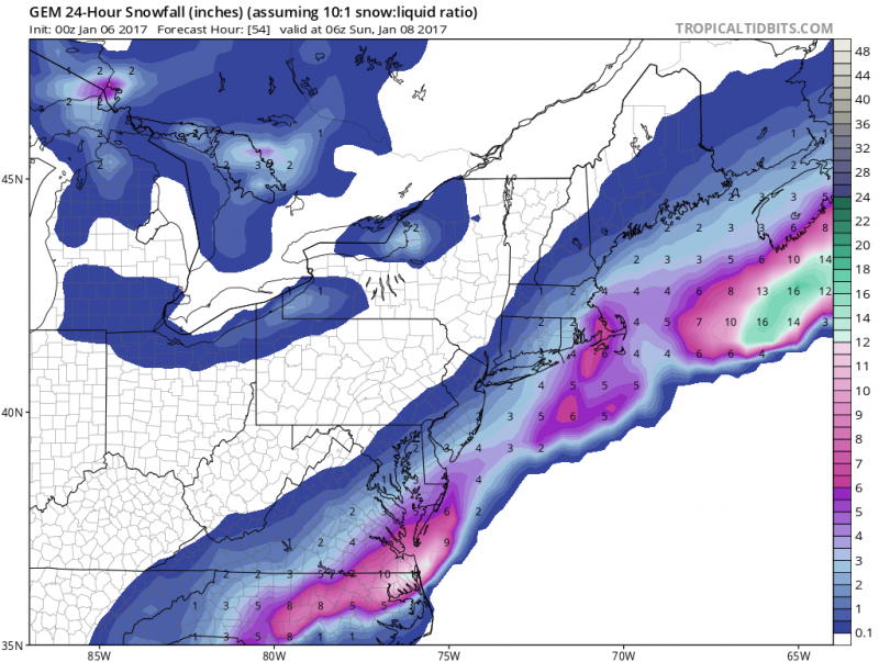
Forecast snow amounts could change as we get closer to the event and even during the event on Saturday due to the sharp northern edge cutoff of this storm. SeaIsleNews.com will keep you updated into the weekend.
What To Expect
Saturday Snow
Time Frame (5am-6pm)
Accumulations of 3”-6”

 A Winter Storm Warning is in effect for Sea Isle City for Saturday for the potential for several inches of snow.
Now that the first system has moved away, the next storm is right on its heels. As I mentioned yesterday this 2nd storm is altogether different. Instead of a developing weak low pressure system with little moisture, like the first one, this one has plenty of moisture coming out of the Gulf of Mexico. This 2nd storm will cause major problems through the Southern States and up the Mid-Atlantic Coast. Highest snow total will be across Southeastern Virginia where 8”-12” of snow is expected. For us, the biggest question has always been how far north will the moisture get to our area.
Snow should arrive around sunrise and could come down heavy at time during the morning and early afternoon hours. With temperatures mainly in the 20s, snow will easily accumulate on roadways causing hazardous travel. Snow should taper off late in the afternoon.
Models continue to have its differences even within 24 hours from the start of the snow. The slightest shift in track will determine whether we see very little snow or significant accumulations.
Let’s look at our options. There are 3 scenarios which the computer models are indicating could be possible.
The American model has tracked this storm furthest from the coast, which would result in very little snow.
 GFS snow projections show accumulations around 1"
 The most aggressive model, another American model, shows a much further north progression with this storm giving us the most snow.
 NAM model snow projections show accumulations 6"-10"
 However, in forecasting, its important not to look at the extreme but a blend of the models. The Canadian and European models actually do just that. Both models track the storm in between both outlying models.
 Canadian/European models projections show snow amounts ranging in the 3"-6" range.
 Forecast snow amounts could change as we get closer to the event and even during the event on Saturday due to the sharp northern edge cutoff of this storm. SeaIsleNews.com will keep you updated into the weekend.
What To Expect
Saturday Snow
Time Frame (5am-6pm)
Accumulations of 3”-6”
