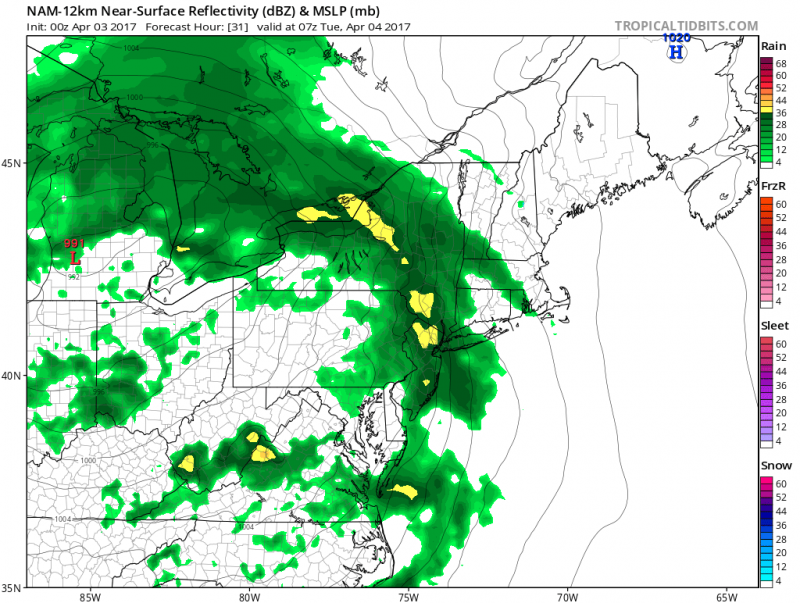
It seems we can get out of this stretch of frequent unsettled weather. Another two storm systems are expected to bring more rain this week.
The first low pressure system is expected to arrive Monday night into Tuesday morning. Sunshine will give way to clouds during the day on Monday. A southerly wind will keep temperatures in the upper 50s with low 60s inland.
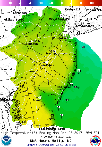 Forecast highs for Monday
Rain will arrive after midnight with a thunderstorm possible.
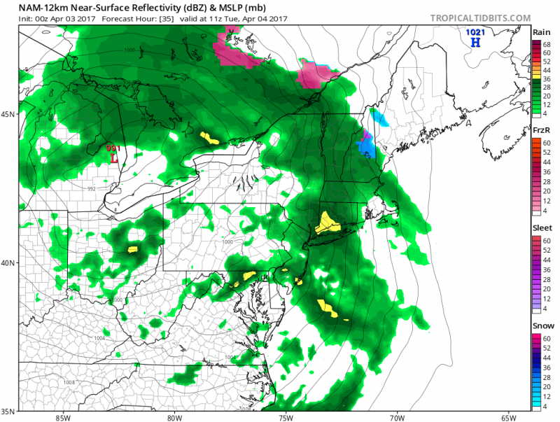
Most of the rain will fall during the overnight hours. A few leftover showers are possible Tuesday morning. However, we do not expect rain amounts to be as robust as last Friday's event. Less than 1" is expected Atlantic and Cape May Counties with higher amounts across Central NJ.
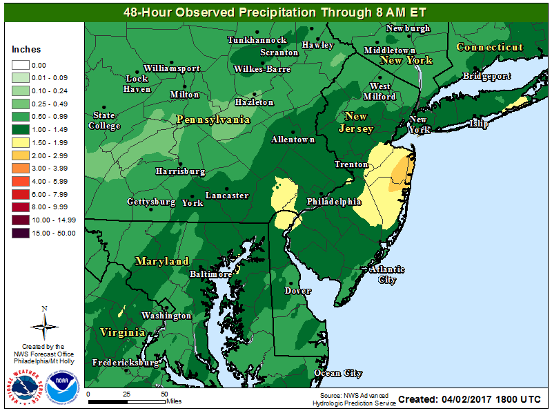
We should begin to dry out Tuesday afternoon with some breaks of sun possible. The good news is breezy southwest winds will keep us on the mild side with temperatures in the mid 60s.
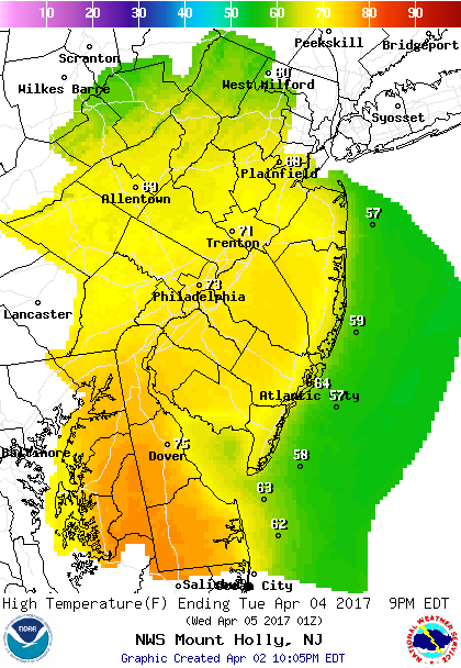 Forecast highs for Tuesday
Wednesday we will get a brief sunny and dry day. Westerly winds will help temperatures to get into the low 60s.
Our next chance of rain will come on Thursday as a stronger storm system in the Ohio Valley moves east. Onshore winds will keep us cooler as well. High temperatures are expected to remain in the 50s.
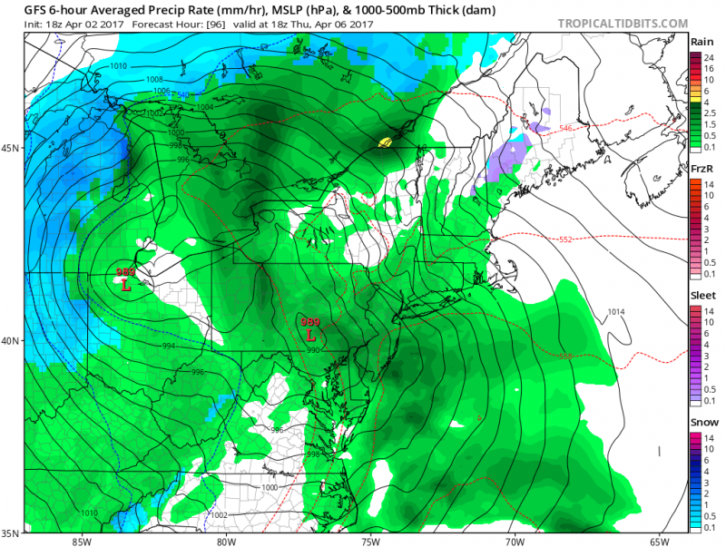
Friday will remain on the cloudy, cool and showery side as the low pressure slowly exits the area. Highs once again remain in the 50s.
Spring Ahead..
A pattern change could be on the horizon. This weekend could mark the beginning of a milder, dry spell that could last for almost a week. Above normal temperatures will span across much of the East Coast which means high temperatures will reach the 60s.
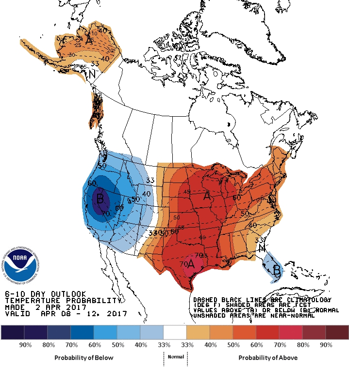
NOAA: 6-10 day forecast shows above normal temperatures across much of the Central and Eastern U.S.
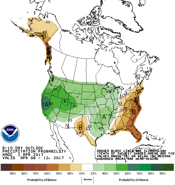
6-10 day precipitation forecast shows drier conditions across the East Coast.
 It seems we can get out of this stretch of frequent unsettled weather. Another two storm systems are expected to bring more rain this week.
The first low pressure system is expected to arrive Monday night into Tuesday morning. Sunshine will give way to clouds during the day on Monday. A southerly wind will keep temperatures in the upper 50s with low 60s inland.
 Forecast highs for Monday
Rain will arrive after midnight with a thunderstorm possible.
 Most of the rain will fall during the overnight hours. A few leftover showers are possible Tuesday morning. However, we do not expect rain amounts to be as robust as last Friday's event. Less than 1" is expected Atlantic and Cape May Counties with higher amounts across Central NJ.
 We should begin to dry out Tuesday afternoon with some breaks of sun possible. The good news is breezy southwest winds will keep us on the mild side with temperatures in the mid 60s.
 Forecast highs for Tuesday
Wednesday we will get a brief sunny and dry day. Westerly winds will help temperatures to get into the low 60s.
Our next chance of rain will come on Thursday as a stronger storm system in the Ohio Valley moves east. Onshore winds will keep us cooler as well. High temperatures are expected to remain in the 50s.
 Friday will remain on the cloudy, cool and showery side as the low pressure slowly exits the area. Highs once again remain in the 50s.
Spring Ahead..
A pattern change could be on the horizon. This weekend could mark the beginning of a milder, dry spell that could last for almost a week. Above normal temperatures will span across much of the East Coast which means high temperatures will reach the 60s.
 NOAA: 6-10 day forecast shows above normal temperatures across much of the Central and Eastern U.S.
 6-10 day precipitation forecast shows drier conditions across the East Coast.