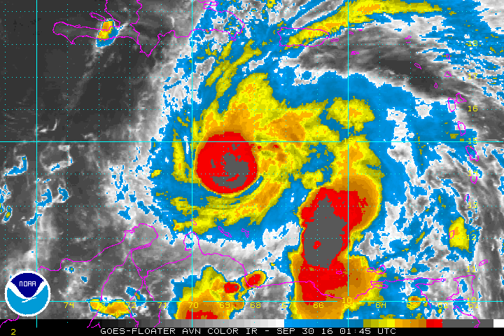
All eyes on Hurricane Matthew as it continues to intensify over the next few days in the Carribean Sea. Matthew's maximum wind speed has reached 80 mph. There is high confidence that this storm will slow down and begin to turn northward by the weekend and threaten Jamaica, Haiti and Cuba.
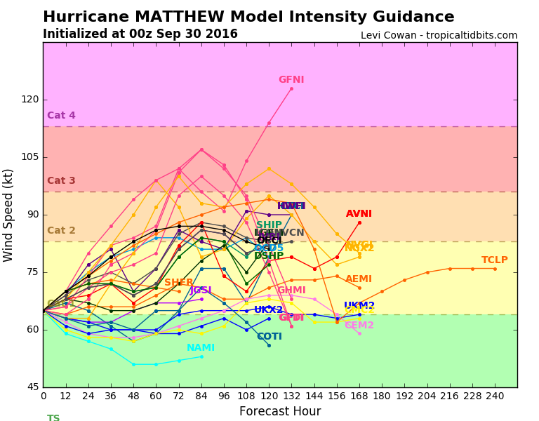 Intensity forecast shows Matthew potentially strengthening into a Category 2 (96-110mph) or possibly a Category 3 (111-130mph)
After that, Matthew will begin to interact with a trough of low pressure over the East Coast which will begin pulling it up the coast. Models continue to diverge once it makes its way north.
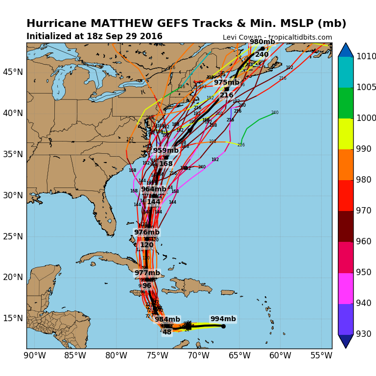
Whether it tracks into the Southeastern U.S., rides along the East Coast, or remains out to sea, its likely that we will see impacts from Matthew in our area. The best case scenario would obviously be if Matthew tracks out to sea, which would only give us rip currents, rough surf and some beach erosion. A track closer to us would increase the threat of heavy rain, strong gusty wind and tidal flooding. Keep in mind, confidence is low with Matthew's track. Until Matthew makes it track northward and emerges into the Bahama region, we will not know specifically what impacts we will receive from this storm.
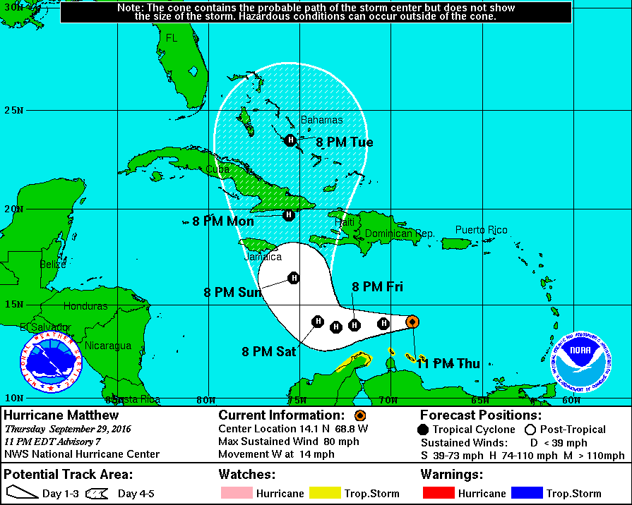
Official Forecast Track from the National Hurricane Center
 All eyes on Hurricane Matthew as it continues to intensify over the next few days in the Carribean Sea. Matthew's maximum wind speed has reached 80 mph. There is high confidence that this storm will slow down and begin to turn northward by the weekend and threaten Jamaica, Haiti and Cuba.
 Intensity forecast shows Matthew potentially strengthening into a Category 2 (96-110mph) or possibly a Category 3 (111-130mph)
 Whether it tracks into the Southeastern U.S., rides along the East Coast, or remains out to sea, its likely that we will see impacts from Matthew in our area. The best case scenario would obviously be if Matthew tracks out to sea, which would only give us rip currents, rough surf and some beach erosion. A track closer to us would increase the threat of heavy rain, strong gusty wind and tidal flooding. Keep in mind, confidence is low with Matthew's track. Until Matthew makes it track northward and emerges into the Bahama region, we will not know specifically what impacts we will receive from this storm.
 Official Forecast Track from the National Hurricane Center