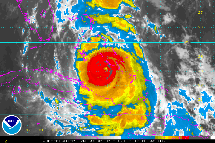
While we will escape the wrath of Hurricane Matthew, it looks like the majority of the Southeast coast could get ravaged by this major hurricane. Matthew will move through the Bahamas on Thursday and take aim at Florida's Coastline. Hurricane warnings are in effect for most of the Florida's Atlantic Coast. Matthew continues to move northwest toward Florida due to a strong Bermuda High Pressure system.
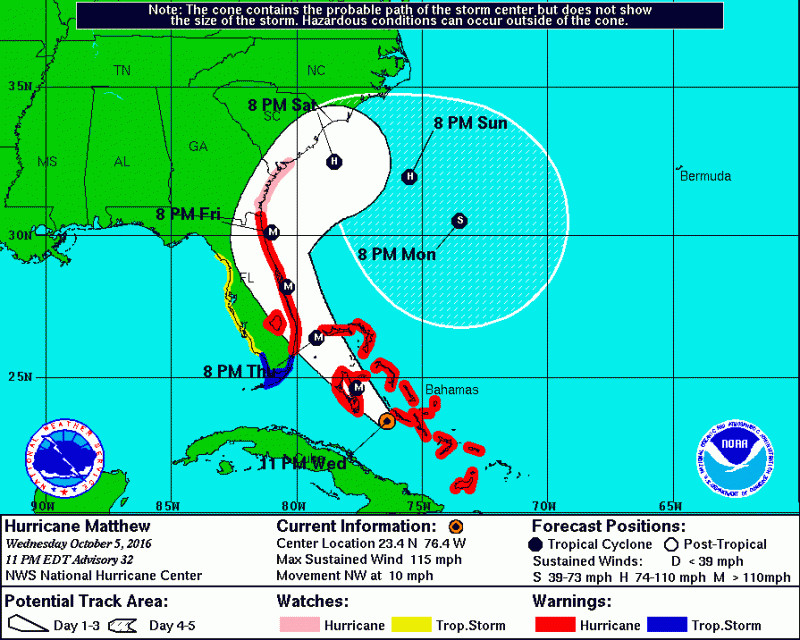
By Friday, Matthew will either make landfall or remain just offshore off the Florida coast. Some computer models have Matthew making landfall around Cape Canaveral. If this were to happen, it would be the 1st major hurricane to strike the U.S. coast since Hurricane Wilma in 2005 which made landfall in Southwest Florida with 120 mph winds.
Matthew will then begin to get pulled northward, then northeastward, as a result of a trough of low pressure approaching from the west. This will cause practically the entire Southeast Coast to potentially experience hurricane force conditions as it curves along the coastline. Matthew could intensify back to a category 4 storm before it reaches Florida on Friday.
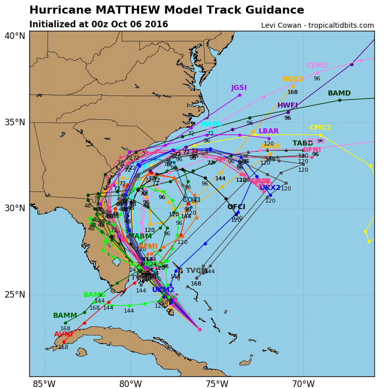
Latest computer models still show that Matthew will not be carried out by the trough of low pressure and instead loop around off the Southeastern U.S. Only impacts that we will see is elevated surf and enhanced rip currents. Beyond this weekend, models also still show that Matthew will loop back around and possibly reach the Florida coast again next week.
OCEAN CITY ANNUAL BLOCK PARTY FORECAST
Since Matthew is expected to miss the area this weekend, that does not mean we will escape the threat of any showers. With a cold front approaching from the west and some moisture briefly getting pulled up from Matthew, expect a cloudy Saturday with the chance of a few showers or a period of rain. It will remain on the cool side, much like this week, with temperatures mainly be in 60s with an northeasterly breeze around 10 mph.
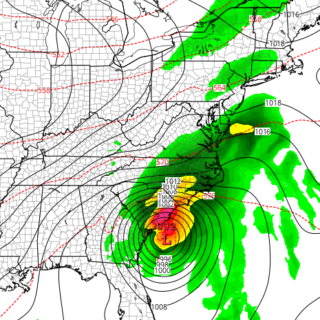 Computer Models shows some moisture reaching the Southern NJ coast during the day on Saturday.
Sunshine will return for Sunday but it will be quite breezy as a result of Matthew well to our south and a strong High Pressure moving in from the west. Temperatures will remain in the 60s with northeasterly winds 15-20mph.
 While we will escape the wrath of Hurricane Matthew, it looks like the majority of the Southeast coast could get ravaged by this major hurricane. Matthew will move through the Bahamas on Thursday and take aim at Florida's Coastline. Hurricane warnings are in effect for most of the Florida's Atlantic Coast. Matthew continues to move northwest toward Florida due to a strong Bermuda High Pressure system.
 By Friday, Matthew will either make landfall or remain just offshore off the Florida coast. Some computer models have Matthew making landfall around Cape Canaveral. If this were to happen, it would be the 1st major hurricane to strike the U.S. coast since Hurricane Wilma in 2005 which made landfall in Southwest Florida with 120 mph winds.
Matthew will then begin to get pulled northward, then northeastward, as a result of a trough of low pressure approaching from the west. This will cause practically the entire Southeast Coast to potentially experience hurricane force conditions as it curves along the coastline. Matthew could intensify back to a category 4 storm before it reaches Florida on Friday.

 Computer Models shows some moisture reaching the Southern NJ coast during the day on Saturday.
Sunshine will return for Sunday but it will be quite breezy as a result of Matthew well to our south and a strong High Pressure moving in from the west. Temperatures will remain in the 60s with northeasterly winds 15-20mph.