By Donald Wittkowski
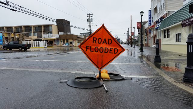
Neil Byrne calls the intersection of 40th Street and Central Avenue a “barometer” of flooding in Sea Isle City.
If stormwater begins to rise in that area, there is a strong possibility flooding will spread to other parts of Sea Isle, said Byrne, who serves as the city’s floodplain manager and construction officer.
Sea Isle officials have long kept a close watch on the flood-prone area, but soon local residents will be keeping an eye on it, too — via a new web camera.
The New Jersey Coastal Coalition plans to install a flood camera on Sea Isle’s Public Works building at 40th Street and Central Avenue that will livestream images on a 24-hour basis. The camera is expected to be ready in four or five weeks and will stream images over the city’s website at http://www.sea-isle-city.nj.us/.
Byrne explained that the camera will allow residents to watch flooding in real time, giving them a chance to move their cars to safety and take other steps to protect their property before it’s too late.
“It’s always one of the first locations that flood,” Byrne said of 40th and Central.

The New Jersey Coastal Coalition, a nonprofit group of 21 communities that joined together in the aftermath of Hurricane Sandy in 2012, is looking for new ways to protect homeowners from flooding.
The livestream broadcast in Sea Isle is part of a pilot program that may eventually include flood cameras in other towns in Cape May and Atlantic counties that are members of the coastal coalition.
“We want to give people the opportunity to see flooding in real time,” said Tom Quirk, the coastal coalition’s executive director.
Sea Isle was selected as the location for the first flood camera because of its strong support for the coalition over the years, Quirk said.
The camera in Sea Isle will be paid for by a $5,000 donation to the coastal coalition by OceanFirst Bank. Quirk said he plans to pursue other private and public grants to secure funding for cameras in other communities.
“All barrier island communities have more in common than not,” Quirk said of how the towns are often battling the dangers of coastal flooding.
Sea Isle’s flood-mitigation strategy includes plans for new pumping stations, drainage improvements and even rock wall-like berms to block stormwater flowing out of the back bays.

By March, Sea Isle is expected to install flashing road signs around town as part of an unprecedented early warning system for flooding.
Designed to prevent motorists from straying into stormwater, the warning system will include about 70 LED-lighted signs strategically located in neighborhoods often hit by flooding. Sea Isle officials say it will be the largest warning system of its kind in New Jersey.
In its never-ending fight against flooding, Sea Isle has also replenished its beaches, fortified its dunes, upgraded its drainage systems and rebuilt its roads over the years.
The Federal Emergency Management Agency, which oversees the flood insurance program, boosted Sea Isle’s community rating from Class 5 to Class 3 in 2018. By moving up the ladder two steps, it means that Sea Isle property owners are eligible for a 35 percent discount on their flood insurance policies. Previously, they had received a 25 percent discount.
Mayor Leonard Desiderio said Sea Isle is the only municipality in New Jersey designated by FEMA as a Class 3 community. Only a handful of cities and counties across the nation are considered Class 3 or higher.


