

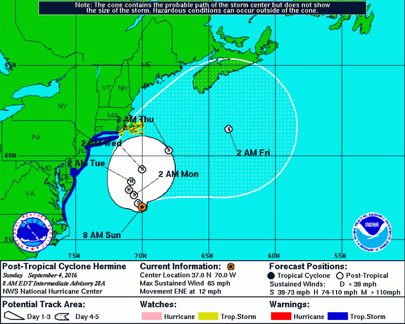
The weather has taken a turn for the better. Hermine has pushed far enough offshore where Tropical Storm condition are not expected. If any rain occurs at all, it will be later tonight and tomorrow as Hermine makes its jog back towards the coast. Otherwise, expect intervals of sun and clouds with breezy conditions through Labor Day and temperatures in the 70s.
 GFS model shows the closest Hermine will get on Monday, with most of the rain remaining offshore.
However, rough surf and rip currents will still occur through Labor Day. With a track further offshore, winds will now be coming from the north, gusting in the 30s at times. As a result, tides have come down significantly and only minor coastal flooding is expected Sunday night and possibly moderate coastal flooding Monday morning.
 Tide forecasts show minor coastal flooding still possible Monday morning.
As a result of Hermine further offshore, wave heights have come down as well. Surf expected to be in the 4-6 foot range with swells up to 12 feet.


