

A wet finish to the weekend as a low pressure system will be moving through on Sunday giving us a period of rain. However, the main concern will be the wind as this storm will rapidly develop offshore into a major winter storm for New England. A High Wind Warning is in effect for our area from Sunday night through Monday afternoon. Northwest winds of 25-35mph wind gusts up to 60mph are expected as this storm.
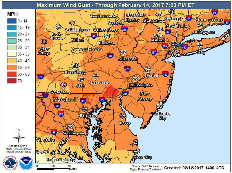
Forecast maximum wind gusts are expected to be 50+mph over a wide area.
With strong winds expected over a long period of time, downed trees and power lines could cause scattered power outages. Also remember to secure any loose outdoor furniture and trash cans.
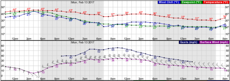 Wind/Temperature Forecast Graph shows the strongest winds will be between Monday 3am-3pm.
It will be mostly sunny on Monday with temperatures in the low 40s, but factor the wind and it will feel like its in the 20s!
The brunt of this storm will be in Maine where blizzard conditions are expected. Snowfall with this storm will be confined to New York & New England as amounts are expected to exceed 8″ with 18″-24″ in Maine.
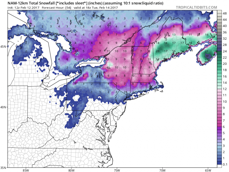
Snowfall totals expected for the New England snowstorm. Near 2 feet possible in Maine. (Courtesy:tropicaltibits.com)
Looking Ahead..
As far as the rest of the week, not much going on. A Northwest flow will dominate keeping us brisk and seasonable cold. High temperatures will stay in the low to mid 40s.
Signs point to another mild stretch starting next weekend where highs could reach 50+ degrees into next week.
 NOAA: 8-14 outlook shows temperatures well above normal through Feb. 25th.


