
Winter has arrived officially today, but the good news is the unseasonably cold air will be leaving us for a while as we move toward the holidays and possibly into the New Year. Over the past couple of weeks, we’ve had a few bouts of Arctic Air pushing temperatures into the 30s and even 20s. Now the overall pattern has shifted which will favor milder air for our area through the holidays.
Last week, I talked about the “Polar Vortex” which resulted in extreme cold air across much of the U.S. This large area of low pressure will retreat towards the North Pole for the remainder of the year. An index called the Arctic Oscillation helps determine what type of weather pattern we can expect. When the index is positive, this means low pressure is near the North Pole. When the index is negative, high pressure builds in the North Pole which causes the “Polar Vortex” to spill southward, as it did last week.
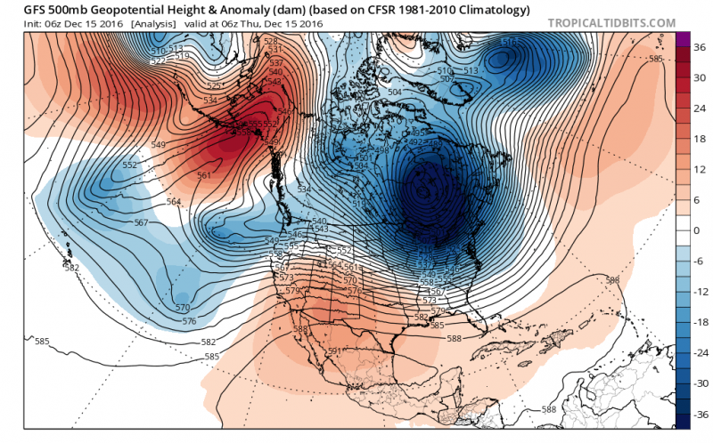 Negative Arctic Oscillation allows “Polar Vortex” or Arctic Air to move south over the U.S. (Courtesy: tropicaltidbits.com)
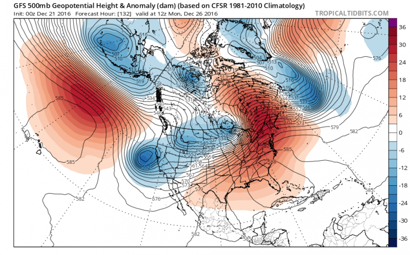
Arctic Oscillation moving into positive phase which allows warmer temperatures in the East. (Courtesy: tropicaltidbits.com)
A ridge of High Pressure will anchor itself across the Southeastern U.S. causing above normal temperatures across the East Coast and below normal temperatures out West.
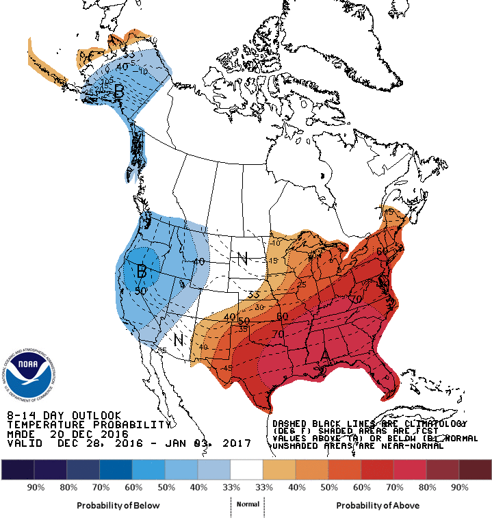
Above normal temperatures expected through the next 2 weeks. (Courtesy: NOAA)
The only chance of rain during the holidays could come on Christmas Eve, other than that precipitation chances will remain low.
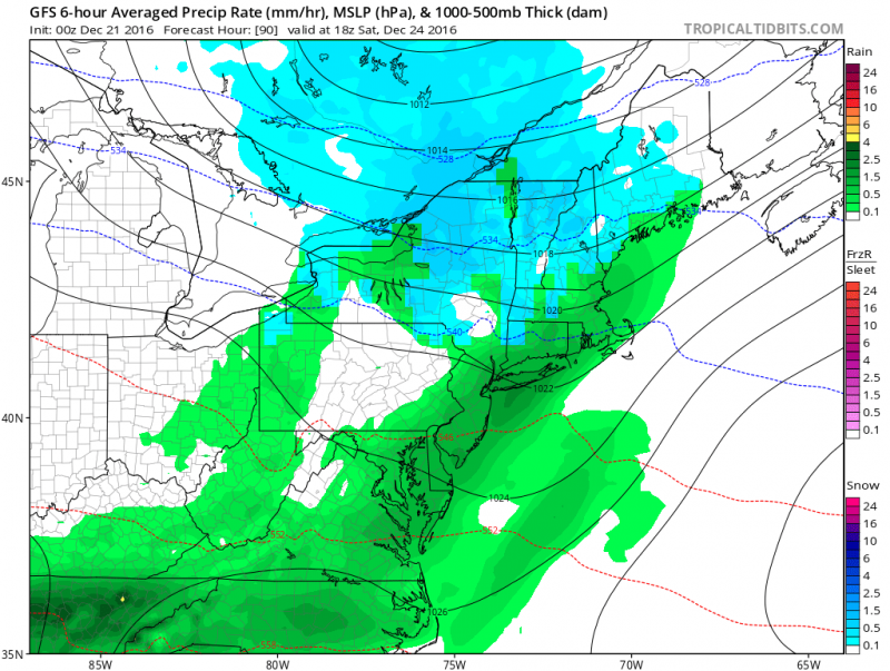
Showers could dampen Christmas Eve. (Courtesy: tropicaltidbits.com)
Temperatures for Christmas Eve and Christmas day will be in the upper 40s to near 50 degrees. Temperatures will climb into the 50s just after Christmas.
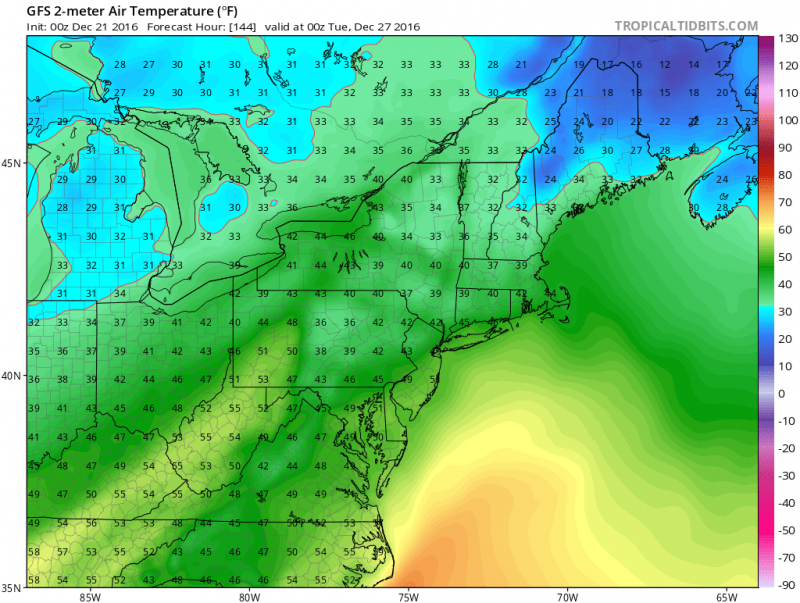
One computer model showing temps should climb into the 50s the day after Christmas. (Courtesy: tropicaltidbits.com)
However, cold air could return by the end of the holidays. Models indicate the only brief shot of cold air over the next couple of weeks could occur around New Years’ Day. Despite the brief cold air, models currently do not show any chance of any snow through the 1st week of January. If your looking for snow, however, the pattern should flip back to more winter-like conditions for mid to late January.


