

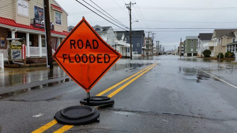
The Cape May County Office of Emergency Management has launched a new flood risk mapping system that will show the real flood risk on local streets and neighborhoods as it relates to specific storm events.
The county OEM has partnered with Civil Solutions (a division of ARH), and the Cape May County Department of Planning for the program, which can be used by the public and county operational staff to track near-real time water level gauges and identify which streets and neighborhoods are likely to be impacted during specific coastal storm events. This is the first GIS-based flood modeling program implemented by any county emergency management office in New Jersey.
The new Flood Risk Mapping program took a year of development, and will be ready for the public to use during the first quarter of 2019.
The new mapping system can be found on the emergency management link on the County’s website, www.capemaycountynj.gov, labeled “Cape May County Tidal Flooding Awareness” and on the County’s IMS website, http://ims.capemaycountynj.gov/ by clicking on “maps.” It can also be linked from municipal and local emergency management websites once they add the link to their sites.
“Interpreting storm forecasts that, at times, contain confusing language and estimates are now translated into the exact information that the public requests: ‘How may it affect my property and neighborhood,’” said Cape May County Emergency Management Director Martin Pagliughi. “This program will be a tremendous benefit to all 16 communities in Cape May County, and assist our municipal partners with making best decisions in their communities relating to sheltering and evacuation decisions.”
The flood risk mapping system is designed to inform emergency management partners and the public when a flood will potentially arrive and estimates the flow for the next four days, depicts graphically on what the flood will look like at pre-determined foot stage intervals, and show areas of the county that are expected to be impacted by storm events.
It also provides an opportunity for the public to simulate future flood forecasts and the potential impact on their neighborhoods.
“This new feature will allow residents and property owners to make best decisions regarding their individual properties based on flood gauge data and forecasts from the National Weather Service and the National Oceanic and Atmospheric Administration,” Cape May County Freeholder Director Gerald Thornton said. “This data is accessible from everywhere, and removes the burden from the public to interpolate flood risks and impacts from forecasts provided to the private and public sectors.”
The Cape May County Office of Emergency Management presented the new program to its municipal partners during a meeting on Dec. 13. A presentation highlighting the program will be conducted at a future Freeholder meeting.
“One huge advantage from the development of this program is the existence of updated topography elevation information currently in the county’s GIS database”, said Brian O’Conner, GIS Specialist with the Cape May County Department of Planning. “This information is seamlessly integrated into the flood risk mapping program and will be updated when required.”
“Local municipalities who are in FEMA’s Community Rating System should gain additional points which will help earn additional flood insurance discounts for their property owners”, Pagliughi said. “We encourage all of our 16 municipalities to include a link to the flood risk mapping program on their appropriate websites.”
During the New Jersey Association of Floodplain Management’s 14th Annual Conference and Exhibition on October 24, the Federal Emergency Management Agency (FEMA) presented an award to Sea Isle City for reaching “Class 3” status in FEMA’s Community Rating System.
Eligible property owners in Class 3 communities receive a 35 percent discount on flood insurance premiums. Sea Isle is the only community in New Jersey to reach Class 3 status – and one of only a handful in the nation with that honor.


